

Do I need a survey?
Unsure whether you need a survey?
Take our quick quiz to find out if your project needs a survey.
Brownfield development planning
Brownfield land development projects enable you to bring previously developed land back to life. They offer fantastic opportunities for professional developers and self-builders. With a brownfield site survey, you can create a design that makes the best possible use of the land. The right measured surveys can also help you to navigate planning constraints and engage with the surrounding community.


The challenges of brownfield land development
What is an industrial, commercial or brownfield land development project?
These projects take place on previously developed land, including sites that have had commercial, residential, agricultural or public sector buildings on them. They may still contain derelict buildings or other structures and infrastructure. The land may be contaminated, overgrown and unkept.
Ground stability
There is a risk of contamination, unstable ground and other hazards.
Site access & logistics
Sites may not be set up to accommodate construction traffic, which can impact the surrounding area.
Current site structures & utilities
Derelict structures and buried utilities can impact development plans.
Flooding & drainage
Large impermeable surfaces, like tarmac, and outdated drainage can increase the flood risk.
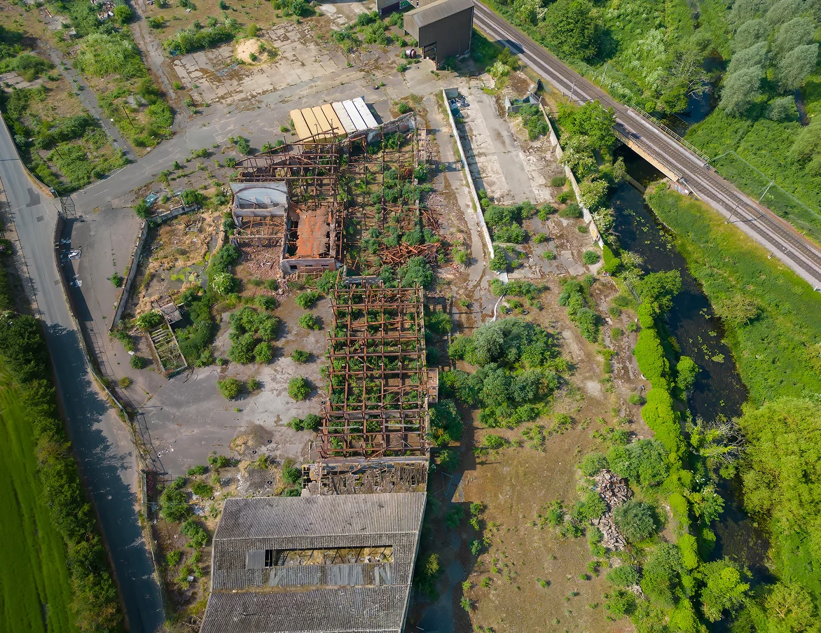
A Guide to Brownfields, Commercial & Industrial Land Development: Key Considerations
Brownfield sites are subject to many of the same planning constraints as other sites. If you are planning a residential build project, it can be useful to consult the local planning authority’s Brownfield Land Register. Updated annually, they list previously developed sites that have been identified as suitable for residential development.
You should be clear on what rules and regulations you need to consider for your brownfield land development. Your local planning department can advise you in detail.
Brownfield sites can have a range of environmental challenges, including asbestos, fly-tipped waste, sensitive eco habitats (especially on derelict sites) and minerals like coal to name a few. Industrial land often has similar issues with soil and groundwater contamination. While there may be records to indicate some of these, you should identify the likelihood of risks. Monitoring and surveying of brownfield sites can help you anticipate potential delays or additional costs.
Commercial developments increasingly need to factor sustainability into their projects. You should become familiar with LEED and BREEAM requirements and consider how to develop any green spaces.
You should carefully plan the site layout, both during construction and the finished development. You should ensure smooth access and consider storage locations for materials. The right design can reduce congestion, increase logistic efficiency and improve safety. Brownfield site surveys can help you take advantage of natural features, and ensure sufficient green space, parking, paths and other elements.
Brownfield land development projects can attract opposition from local residents. This is especially true if the negative impacts, like increased traffic and intrusion, are more apparent than the positive ones. Larger developments and those that significantly impact the surrounding community will draw more attention.
You should prioritise stakeholder and community engagement early in your project. Your planning process may require some public consultation anyway. The earlier you can develop good relationships with the local community, the better. Ensure you can demonstrate the project’s benefits, both in the short term (e.g. local construction jobs) and the long term (e.g revitalising neglected land).
Speak to our experts
Get free advice or a quote from our experienced team.
We’re known for our reliable, quality service and attention to detail.

How surveys benefit industrial, commercial or brownfield land development projects
Accurate measured data from brownfield site surveys provides an understanding of site conditions and ground stability. You can determine whether areas of your brownfield land are suitable for heavy loads or large structures, like office buildings and factories. Land surveys can find out if there is any uneven terrain that will impact your brownfield development. This enables architects, landscapers and engineers to design in ways best suited to the landscape.
Topographical surveys can all give you a better visual representation of your site. This can be essential for brownfield land development projects with large-scale or complex layouts. You’ll be able to see your limits and opportunities, plus visualise the layout of new structures, roads and other features. Data can be provided in a variety of formats, so you can easily communicate your vision to key stakeholders.
Brownfield site surveys will give you a clear idea of the site’s boundaries, existing structures and infrastructure. This can help you to plan access and reduce logistics delays, which can be a particular challenge on smaller brownfield sites, like a self-build.
With more precise details about the site’s surroundings, you’ll also have the right information to work out how any construction activity will impact the area nearby. This can inform your brownfield land development project logistics and help you decide how to engage with the local community.
River and flood surveys help to identify increased flood risks near to a site. Other surveys can show whether the size and shape of your brownfield land and its surroundings contribute to an increased flood risk. You can then take advantage of any natural features the site already has to reduce the risk. Natural flood management techniques reduce the amount of surface water by intercepting it with plants, trees and land depressions.
What surveys could you need?
 As-Built Surveys
A fully up-to-date record of what has just been constructed, ensuring it matches the proposed plans. Useful for producing further plans that require an accurate site layout.
Floor Level Surveys
Quality survey check for various floor construction stages, from existing floors to newly constructed slabs.
Garden Surveys
Highly detailed, specialist topographical survey for garden landscaping and redesigns.
GPS Surveys
Ideal for covering large open spaces, like fields, or where access may be restricted or challenging.
Measured Building Surveys
3D site survey of a building’s layout and structure that can also be used to produce floor plans, elevations and cross-section drawings.
Movement Monitoring Surveys
Tracking and recording movement or alterations, such as crack monitoring and land movements, in either a built structure or a landform.
River & Floodplain Surveys
Surveys of riverbanks and beds, as well as adjacent floodplains. We record water levels and significant features for flood risk assessments and erosion monitoring.
Road Surveys
Comprehensive record of current road layouts and levels, including kerbs, street furniture and road markings. Ideal for visibility splays and new highways designs.
Setting Out
Geocordinated setting out services for building groundworks and steelworks for new housing, commercial and industrial sites.
Surveys for Land Registry Title Plans
Site surveys for creating Land Registry compliant plans to record areas of sale, transfer, correction or first registration.
Topographical Surveys
Accurate, scaled plan of a site’s terrain, and a record of the position and levels of both manmade and natural features.
Volumetric Surveys & Terrain Models
Measuring the total amount of stockpiled, extracted or collected materials and aggregates. Suitable for construction, calculating and auditing.
How we work
 Step 01
Request a quote
We’ll need your project’s address and a site plan. We’ll then get in touch for a consultation to confirm site details and understand exactly what your project needs.
 Step 02
Quote accepted
Once your project is confirmed with us, we’ll arrange a convenient date for your survey.
 Step 03
We complete your survey
We’ll visit your project site to carry out the survey. We can meet you on site if needed. We will then process the survey data and create a survey drawing.
 Step 04
Receive your survey
We’ll share the survey data with you, usually within a few days. We use industry standard file types and can issue all the drawings in multiple formats.
Who we work with


Why choose Cheshire Surveys
We provide a range of surveys and related services across the North West, Cheshire, North Staffordshire and North Wales.

Passion & technical expertise

25+ years experience

Quality services tailored to your project


