

Do I need a survey?
Unsure whether you need a survey?
Take our quick quiz to find out if your project needs a survey.
Smooth civil site development
Civil engineering plays a key role in supporting a range of construction projects during the land development process. From new housing estates to commercial subdivisions, there can be a number of challenges. Understanding how civil engineering and surveying services work together can help you to make a project safe, compliant and sustainable. They ensure you have all the detailed data and knowledge required for a successful project.


How civil engineering operations fit into land development
Civil engineering challenges
Civil site development is the starting point to transform bare land for residential, commercial, industrial or infrastructure projects. These operations include any construction or engineering work that alters the land’s physical characteristics to make it suitable. This can involve significant earthworks, substructures and infrastructure works.
Civil engineers also need to consider connections to amenities, the environmental impact and careful planning to fit with the natural surroundings. Land surveys provide critical civil engineering support, ensuring accuracy, legal compliance and efficient project execution.
Elevations and uneven terrain
Understanding grading and other topographical variances.
Drainage
External and internal drainage points need to be accurately identified.
Soil conditions
Soil can vary across a site and impact the construction of structures, including foundations.
Coordination
Good coordination with others is needed to keep project tasks on schedule.

A Guide to Civil Engineering & Site Development: Key Considerations
Having good data about the current site is vital for planning grading, road placement and creating suitable building surfaces. Sites in lower areas or near to water may be at risk of flooding and site analysis can help you plan your civil site development to mitigate against this.
Drainage is one of the first on-site activities during land development projects. Accurate level data for a site and an understanding of any existing drainage is key. With quality data, you can make informed decisions about the best drainage solutions.
Civil engineering works will often need to be coordinated alongside the work of other professionals like architects, landscape designers and construction workers. It’s important to ensure you have good communication channels and information can be shared clearly. This will enable smooth collaboration during the site planning and development.
Speak to our experts
Get free advice or a quote from our experienced team.
We’re known for our reliable, quality service and attention to detail.
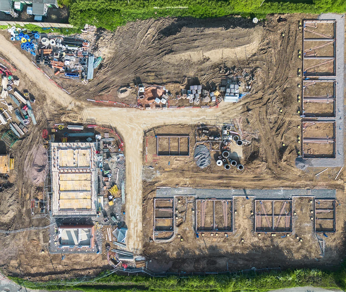
Civil engineering and surveying: how land surveys support projects
Land surveyors can provide civil engineers with detailed information about both natural and manmade features of a site. A topographical survey maps land features, property boundaries and infrastructure to support site preparation and earthworks. This includes operations like clearing and grading the land area, excavation and embankment formation, and ground stabilisation and compaction.
These survey details enable you to account for everything from varied grading and well-established hedgerows to fences and kerbs. With precise measurements and in-depth data upfront, you can plan ahead with greater accuracy for costs and timelines.
Having more accurate data can help to reveal potential risks earlier in the process. Factors like unstable soil and flood-prone areas require additional planning considerations. Land surveys can help to identify these early on, so you can avoid delays later and plan around them.
Land surveyors can also provide information on high-risk projects that could be unsafe to access, like bridges. Using non-contact survey techniques they can gain an overview of complex terrain, structures and their surroundings for more in-depth information.
Clear data in a variety of formats can help to ensure clear communication with other professionals and stakeholders. This in turn will increase the accuracy and efficiency of construction sites, helping to keep projects on track. We can ensure you receive copies of your survey reports in the range of formats you need.
In addition, our setting out translates architectural and structural design drawings to the construction site. Your project team can build with confidence, knowing that on-site works accurately reflect the plans.
We can provide cut and fill analysis and digital terrain models, including 3D ground models. Our land surveyors can prepare digital terrain models for use directly in machines fitted with machine control and GPS systems. These ensure greater accuracy and efficiency for excavation and other groundworks.
Setting our engineers perform precise civil engineering setting out for various works, including road layouts, foundations and steel frame buildings. They can assist with site groundworks and substructure installations. This can include setting out the position of strip foundation, piling, ground beams, and raft foundations and retaining walls.
Our drainage setting out includes drainage, external foul and surface drainage, as well as pop up positions inside a building. This enables you to know where drainage is coming in and out of the building.
A fully digitised service enables us to check for any discrepancies in the design process before arriving on site. We can calculate coordinates in advance, so our time on site is used more efficiently.
What surveys could you need?
 As-Built Surveys
A fully up-to-date record of what has just been constructed, ensuring it matches the proposed plans. Useful for producing further plans that require an accurate site layout.
Setting Out
Geocordinated setting out services for building groundworks and steelworks for new housing, commercial and industrial sites.
Topographical Surveys
Accurate, scaled plan of a site’s terrain, and a record of the position and levels of both manmade and natural features.
Volumetric Surveys & Terrain Models
Measuring the total amount of stockpiled, extracted or collected materials and aggregates. Suitable for construction, calculating and auditing.
How we work
 Step 01
Request a quote
We’ll need your project’s address and a site plan. We’ll then get in touch for a consultation to confirm site details and understand exactly what your project needs.
 Step 02
Quote accepted
Once your project is confirmed with us, we’ll arrange a convenient date for your survey.
 Step 03
We complete your survey
We’ll visit your project site to carry out the survey. We can meet you on site if needed. We will then process the survey data and create a survey drawing.
 Step 04
Receive your survey
We’ll share the survey data with you, usually within a few days. We use industry standard file types and can issue all the drawings in multiple formats.
Who we work with


Why choose Cheshire Surveys
We provide a range of surveys and related services across the North West, Cheshire, North Staffordshire and North Wales.

Passion & technical expertise

25+ years experience

Quality services tailored to your project


